01 · MODEL
Grow the fire
Runs FlamMap, the US Forest Service fire model, with Trajanus's own inputs: landscape edits and fuel moisture learned from past fires.
Wildland Fire Modelling, Analysis, and Mapping Tool
Named for the Osborne Firefinder, the sighting instrument in fire lookout towers: a lookout aims it at a column of smoke and reads the bearing, and the bearings from two towers cross where the fire is. Osborne does two jobs: it models fire and checks the model against real fires, and, with Tessera, it is planned to turn the model into warnings for the people on the line.
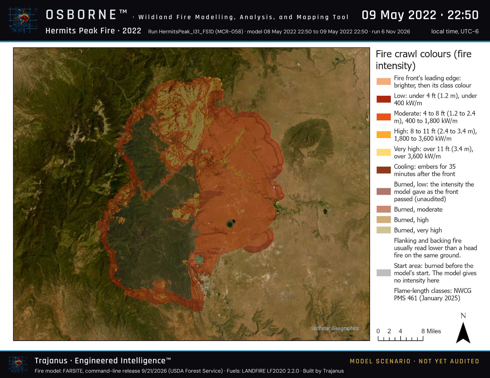 ArcGIS Pro output · Osborne run
01 · MODEL
Runs FlamMap, the US Forest Service fire model, with Trajanus's own inputs: landscape edits and fuel moisture learned from past fires.
02 · MAP
Paints the fire's growth on satellite imagery, coloured by fireline intensity, beside the mapped perimeters. Maps go to ArcGIS Pro and ArcGIS Online.
03 · WARN
Planned: will check crew positions from ArcGIS Field Maps, Garmin units or phones against the model's fire arrival times, and give incident command threat levels. Decision support, never a substitute for LCES.
Six workspaces, in order
Each workspace is one tab of the app. The steps to press are on the left, the map is in the middle, and the controls are on the right.
In: where the fire is, and its year.
What it does: orders the landscape for that area from the LANDFIRE Product Service at 30 metres (elevation, slope, aspect, fuel model and the four canopy layers), from the LANDFIRE version made before the fire, and checks what arrives.
Out: a checked landscape file, with a record of where every layer came from.
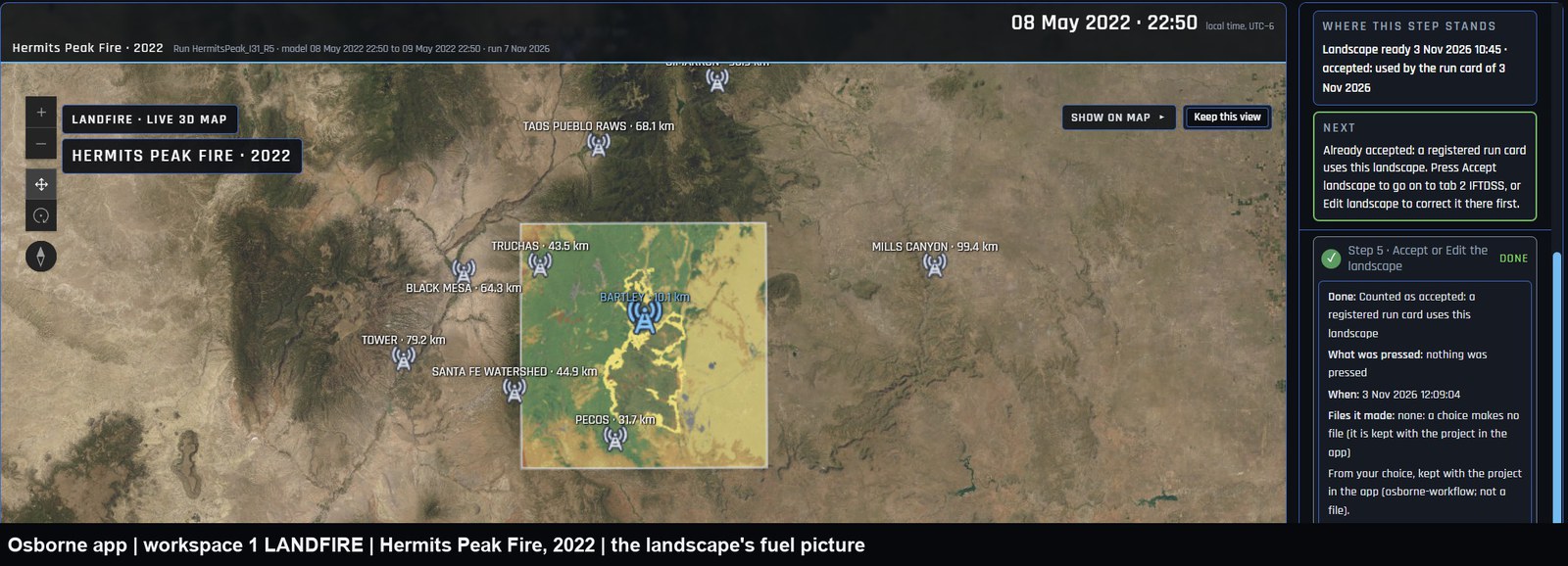 Osborne app · 1 LANDFIRE · Hermits Peak Fire, 2022
In: the landscape from workspace 1.
What it does: lets the landscape be accepted as LANDFIRE delivered it, or corrected in IFTDSS, the Interagency Fuel Treatment Decision Support System, and compares an edited landscape with the original, cell for cell.
Out: the landscape version the run will use, and a record of the choice.
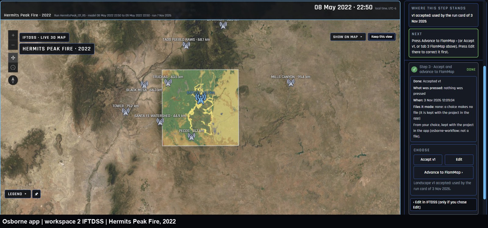 Osborne app · 2 IFTDSS · Hermits Peak Fire, 2022
In: the landscape, a starting fire from a mapped perimeter, the weather the stations recorded, and a run card that fixes every setting.
What it does: registers the run card, runs FlamMap, the US Forest Service fire model, and scores the model's growth against the next mapped perimeter.
Out: the fire's arrival-time and intensity grids, a score, and a one-page write-up of the run in plain words.
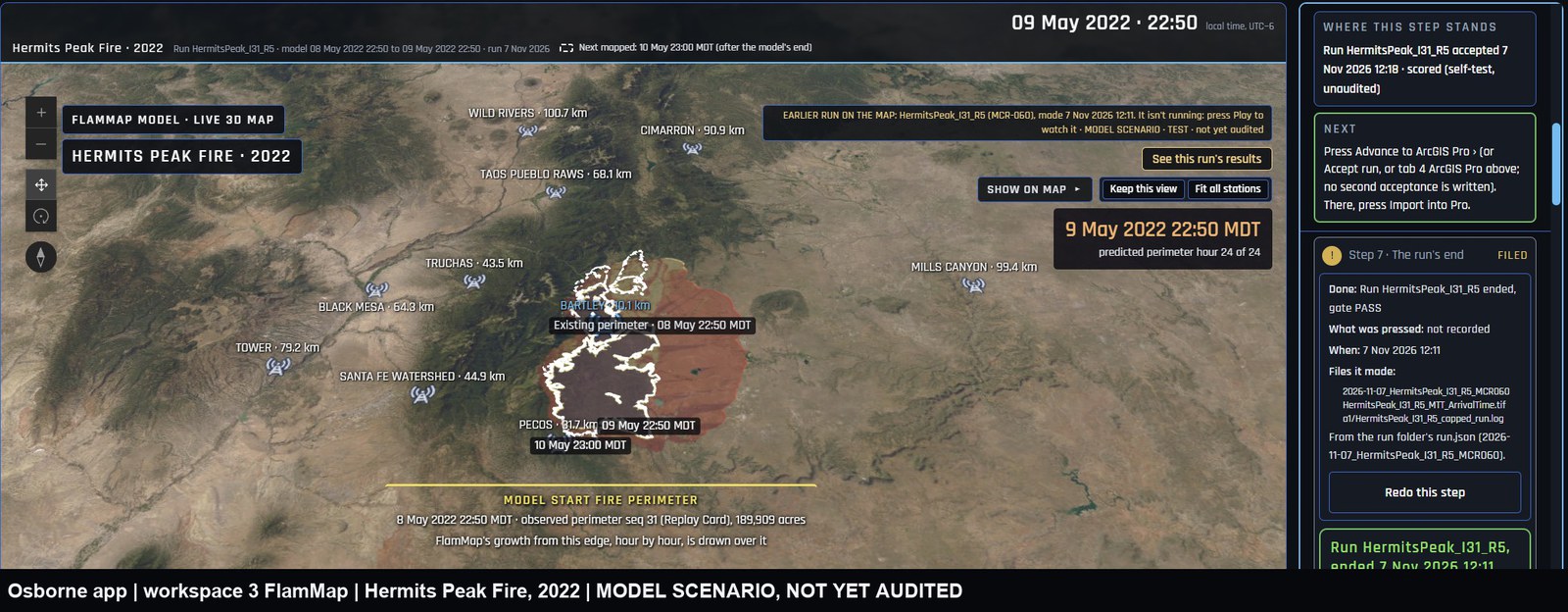 Osborne app · 3 FlamMap · Hermits Peak Fire, 2022Model scenario · not yet audited
In: a finished run.
What it does: imports the run into an ArcGIS Pro project and plays the fire's growth on satellite imagery, two model minutes per frame, coloured by the run's own fireline intensity, beside the mapped perimeters.
Out: an ArcGIS Pro project and a finished map layout.
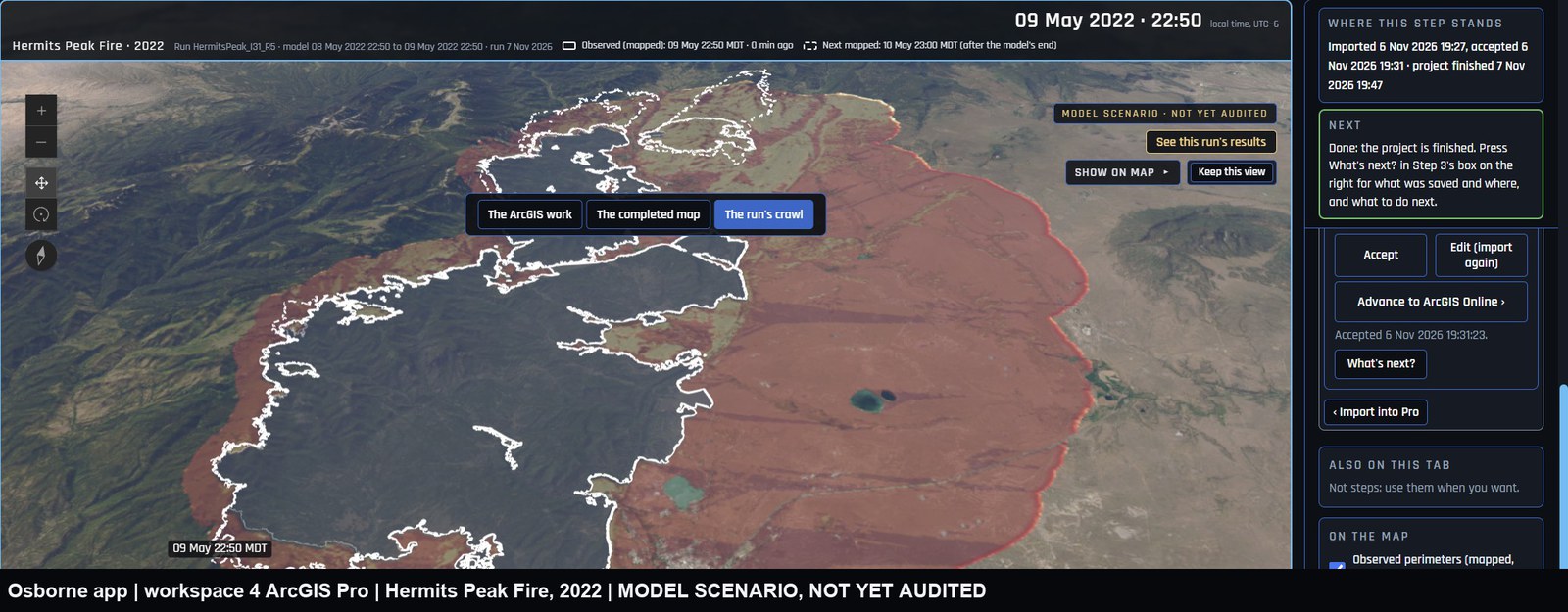 Osborne app · 4 ArcGIS Pro · Hermits Peak Fire, 2022Model scenario · not yet audited
In: the ArcGIS Pro project.
What it does: publishes the run's layers to ArcGIS Online as a private item, and records that the item was checked.
Out: a hosted feature layer in ArcGIS Online, private until it is shared with the people who need it.
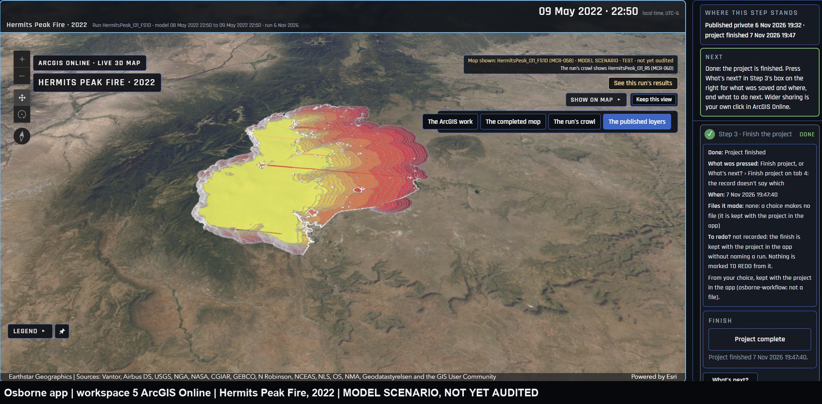 Osborne app · 5 ArcGIS Online · Hermits Peak Fire, 2022Model scenario · not yet audited
In: crew positions, and a run's fire arrival times.
What it will do: check each position against the model's arrival times and give incident command threat levels.
Out: time-to-fire warnings. Tessera is planned, not built yet. Decision support, never a substitute for LCES.
ArcGIS Pro layout · Hermits Peak Fire, 2022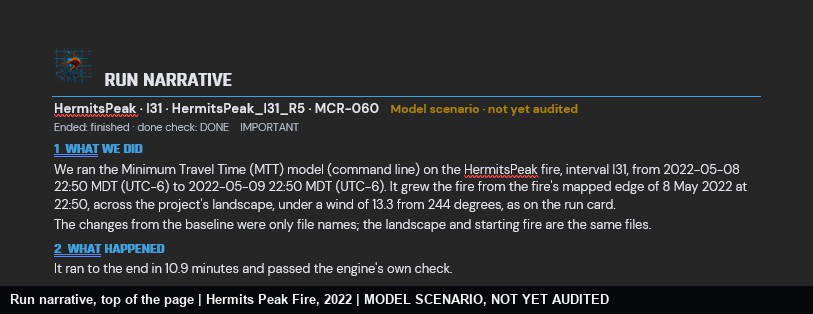 Run narrative · Hermits Peak Fire, 2022Model scenario · not yet audited
A score: the model's growth against the next mapped perimeter. A self-test, not yet audited.
Replay
Every fire that has already burned is a test the model can take. Osborne takes them one at a time and keeps what it learns.
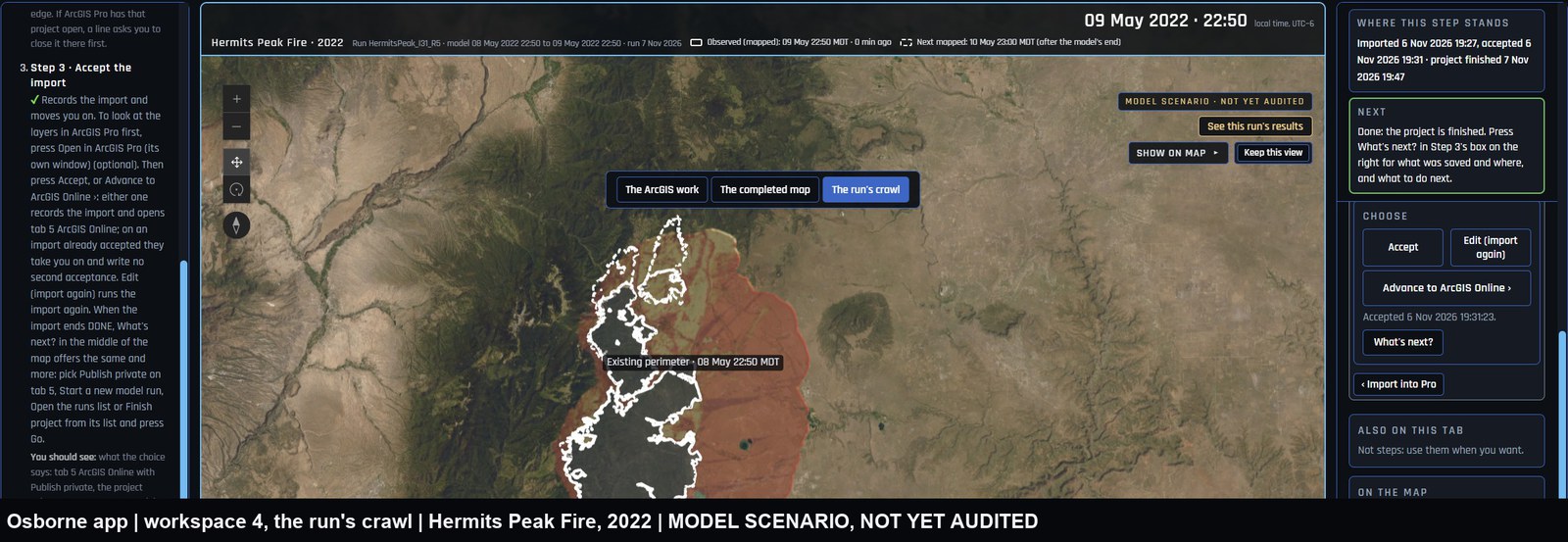 Osborne app · tab 4 · replay
For counties: fire behaviour for community wildfire protection plans, run by Trajanus and delivered into your own ArcGIS Online.
Crew tracking and threat levels (planned): crews will share position through ArcGIS Field Maps, we will run the model and the threat check, and incident command will get a web map or dashboard. Nothing to install.
For agencies that want to run it themselves, on their own workstations, with their own ArcGIS.
Built on public fire science
Osborne does not invent its own physics in a black box. It runs the fire models the federal fire science labs built, on the national data the agencies publish, and checks the result against the record.
FlamMap, FARSITE and the minimum-travel-time model, developed at the Missoula Fire Sciences Laboratory, are the fire-growth models behind Osborne's runs.
The national 30-metre maps of fuels, vegetation and terrain from the Forest Service and the Department of the Interior. Every run starts from a LANDFIRE landscape.
Every replay is scored against recorded fire perimeters: NIFC's archive of incident perimeters, and a published dataset of perimeters mapped by the national infrared program (NIROPS).
Recorded weather from Remote Automatic Weather Stations (RAWS), through the interagency Fire Environment Mapping System (FEMS), drives every replay.
Every Osborne map is made in ArcGIS Pro and published to ArcGIS Online. Trajanus is a member of the Esri Partner Network.
Fire behaviour classes on our maps follow the National Wildfire Coordinating Group, such as the flame-length classes of PMS 461.
Osborne uses these organisations' published tools, data and standards. It is not made, endorsed or certified by them.
We would like to hear from you.